


 |
| Gold in Quartz Photo by Rob Lavinsky |
Unlike placer gold hard rock or lode gold is much more expensive to locate, but under the right conditions isn’t impossible. Most lode deposits are found by following placer gold deposits in a stream until the deposit suddenly chokes off then following float up hill until you finally find the Mother Lode. Most lode deposits are always shedding float that goes downhill in an ever widening fan of the host rock.
Although gold can be found in virtually any rock type its usual home is in white, milky quartz that is readily distinguished from the host rock as termed in the mining industry “gangue.” The white rock stands out so often pieces of it can be observed washing down mountainsides from its source with the naked eye or by using binoculars.
Although most hard rock gold is found in quartz veins that are usually readily visible, and the thinner the vein often the more gold it contains. Another prime target for hard rock gold is the rock conglomeratewhere the biggest of all gold deposits are found in the Witwatersrand in South Africa . These deposits have produced around 40% of all the gold that has ever been mined. Deposits of this type also contain uranium and rare earth elements in payable amounts making it entirely possible to find deposits of this nature with a Geiger counter. The gold/uranium deposits at Elliot Lake, Ontario are of this nature.
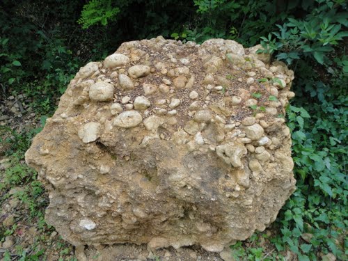 |
| Quartz pebble conglomerate a likely place to find gold Photo by Wiki-Schack |
In many parts of the world it is extremely hard to see float because the area is covered with deep overburden so it is necessary to use other methods of finding hard rock gold; one of the most popular is using aeromagnetic maps or other geophysical methods like ground resistivity. Aeromagnetic mapswork on the principle that gold often occurs associated with the mineral magnetite or other iron bearing minerals like ilmenitecausing the prospector to carefully examine the area around magnetic highs on an aeromagnetic map.
 |
| An analog multimeter that can be used for several different parameters in geophysical prospecting Photo by KENPAI |
Ground resistivity is one of many different geophysical techniques use to find ore deposits based upon the amount of underground corrosion that takes place in an orebody. This is done using a multimeter that has high impedance and a strand of wire. For convenience most of these rigs have 1,000 feet of wire mounted on a reel. In use an area 1,000’ x 1,000’ is measured out on the land. Parallel lines are drawn on its surface with readings taken from 100 feet apart to 10 feet apart along the lines. The highest readings are connected with a line, and each successive lower reading until a map that resembles a topographic map is generated.
Any number of different parameters can be measured using this method, but the best explanation of their use is explained in a book about practical geophysics. Parasinisauthored a book on the subject that is still available today in the 1960s.
Any number of different parameters can be measured using this method, but the best explanation of their use is explained in a book about practical geophysics. Parasinisauthored a book on the subject that is still available today in the 1960s.